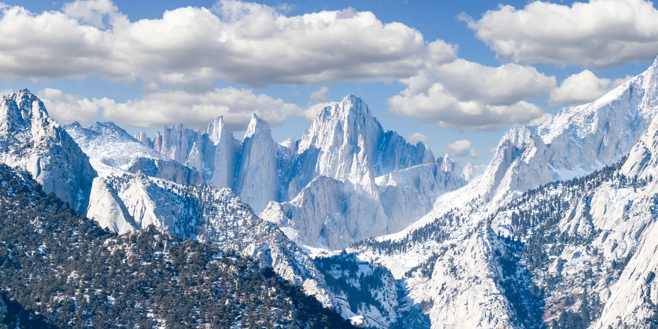
Cruise south of Bishop on the eastern Sierra's main artery—Highway 395—and a massive wall of peaks rises to the west, dwarfing the town of Lone Pine and its Western-style storefronts. Crowning those granite behemoths is Mount Whitney, the loftiest peak in the lower 48 states, which scrapes the sky at 14,505 feet.
Besides its chart-topping height, what distinguishes Whitney from other California "fourteeners" is the world-famous hiking trail leading to its summit. During the summer months, you don't need mountaineering skills to reach the top, just top-notch fitness, an abundance of grit, and a permit lashed to your pack.
How to Hike or Backpack to Mount Whitney's Summit
For some hikers, summiting Mount Whitney is the ultimate metaphor for achievement, the trophy that says you've gone as high as possible in the contiguous United States. The peak's summit views are sublime: Its commanding position in the Sierra delivers a broad perspective on the range's stark, tree-less spine and a granite landscape punctuated by deep blue lakes. The panorama encompasses the White Mountains, Death Valley National Park, and Lone Pine, plus much of Sequoia and Kings Canyon National Parks.
But nothing this rewarding comes without a price. The summit trek challenges even the fittest hikers with its 22-mile distance and 6,200 feet of elevation change. Most hikers start at Whitney Portal before sunrise and complete the trip in 12 to 14 hours. Others carry a backpack and split the trip into two or more days, camping along the route at Outpost Camp or Trail Camp.
Just negotiating the permit system requires perseverance: From May 1 to November 1, only 100 day-hikers and 60 backpackers may start the summit trek from Whitney Portal each day, so you must secure a permit in advance. July, August, and September are the most popular—that's when the trail is most likely to be snow-free.
Advance planners can apply for the annual Mount Whitney Lottery, which takes place February 1 through March 15. If you miss that window, wait until May 1, when web reservations open up on Recreation.gov. If you still can't get the dates you want, check back two weeks before your trip, when additional permits are released.
Where to See and Experience Mount Whitney
You can savor Mount Whitney's splendors without burning out your quadriceps. Get a wide-angle view of its soaring turrets from the Eastern Sierra Interagency Visitor Center south of Lone Pine. Or drive west to the Alabama Hills and snap photos of Whitney's craggy needles framed in the graceful curves of Mobius Arch.
To get a closer look, let your car do some mountain climbing: Zigzag 13 miles up Whitney Portal Road, gaining nearly 5,000 feet to the pavement’s end. The enormous granite cliffs surrounding Whitney Portal seem insurmountable, but this is where summit-bound hikers start their treks.
Stand near the pines and breathe the rarified air or stop in to the Whitney Portal Store to purchase a Mount Whitney t-shirt or fridge magnet. Fuel up with pancakes that drape off your plate or a mountain-sized hamburger.
You can also explore the terrain on shorter, not-so-challenging hikes. The first 2.7 miles of the Mount Whitney Trail lead to Lone Pine Lake, a sparkling blue alpine tarn that invites lingering. (Permits are required to hike beyond the lake.) Or follow the Whitney Portal National Recreation Trail four miles downhill to Lone Pine Campground, following the path of Lone Pine Creek. Save some energy for the uphill return trip or have your shuttle car waiting at the campground.
Alternative Ways to Summit Mount Whitney
Mount Whitney is also accessible from other Sierra trails, including Inyo National Forest's Cottonwood Passand Sequoia National Park's High Sierra Trail, but the route is much longer than the Whitney Portal option. Consider joining a guided trip with outfitters like SWS Mountain Guides, Sierra Mountain Center, or Southern Yosemite Mountain Guides. They'll take care of all the logistics so all you need to do is train.
